https://ph.trip.com/moments/poi-danan-mountain-56809940
2.5
4.8/5
13則評價
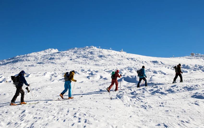
Mountain climbing
Danan Mountain is located in the border area between Zengguang Town and Haifeng County, Huidong County, Guangdong Province. Here, the peaks stand tall, the forests are deep and the valleys are secluded, the mountainside is white and fluttering, the streams are running down the mountain, and three or five villages are scattered among them, like a paradise. Within a radius of two or three kilometers, there are three or four peaks over a thousand meters.
展示更多
Danan Mountain地址:
Huidong County, Huizhou City (746 meters southeast of Nanshan Village)
Danan Mountain建議觀光時間:
1-3 hours
Danan Mountain票價
免費入場
Huizhou | Guangdong's Little Wugong Mountain—Huizhou Danao Mountain
Huizhou is home to a mountain called Danao Mountain, often referred to as Guangdong's version of Little Wugong Mountain. In summer, the mountain is covered in lush green grass, while in autumn and winter, it transforms into a golden sea of reeds (similar to what we call silvergrass in Hong Kong).
Danao Mountain is located in the area bordering Huidong and Haifeng. It gets its name from the nearby Nanshan Temple and Nanshan River. The mountain range consists of five connected peaks, with the highest being Shuidi Mountain, standing at 1,290 meters above sea level. Surrounded by picturesque scenery, with clouds drifting among the peaks, it's no wonder hiking enthusiasts are drawn to this place. 🙈
I visited Wugong Mountain in winter but missed the lush green grasslands; I went to Danao Mountain in summer but didn't see the golden reeds. Next time, I'll switch the seasons for these two hikes to truly satisfy my hiking desires. 😂
Danao Mountain ⛰️ offers several hiking routes, some requiring two days to complete.
1– Highlight Route: Longyan Temple—Golden Reed Fields—Marshland—Futou Rock Summit—Iron Tower—Dawang Temple (Approx. 5-6 hours)
2– Half Route: Longyan Temple—Longyan Temple Downhill Point—Grass Slope Summit—Shuidi Mountain—Golden Reed Fields—Marshland—Futou Rock Summit—Iron Tower—Dawang Temple
3– Full Circuit: Yuantan Village—Creek and Big Tree—Niupizhang Turn—Explosive Rock Summit—Longyan Temple Downhill Point—Grass Slope Summit—Shuidi Mountain—Golden Reed Fields—Marshland (Camping Site)—Futou Rock Summit—Iron Tower—Dawang Temple (Recommended to prepare for 2+ days)
For those unfamiliar with the routes, it's advisable to join a group tour led by local guides. Not only is it safer, but it also eliminates transportation worries.
(During the hike, you may encounter many fellow hikers, some even climbing at night to catch the sunrise before descending. Truly admirable! 👍🏻)
If you're interested in joining a one-day tour, there are many mini-programs available. Depending on your departure location, you can search for suitable programs nearby. 🙈
⛰️⛰️⛰️
Safety first, hike within your limits.
⛰️⛰️⛰️
Prepare sufficient water and snacks for emergencies.
⛰️⛰️⛰️
Wear comfortable hiking shoes (preferably non-slip), and bring lightweight spare clothes and a jacket (for wind and sun protection).
⛰️⛰️⛰️
In summer, be mindful of sun protection and heatstroke 🥵. Consider carrying a small water spray bottle and a mini fan for cooling down when needed.
⛰️⛰️⛰️
Bring lightweight rain gear, a headlamp/flashlight for emergencies.
⛰️⛰️⛰️
Protecting the environment is everyone's responsibility. Take your trash with you—it's the least respect we can show to nature. 😊
Transportation:
🚗 Self-driving is recommended. Navigate directly to Huizhou Dawang Temple, where parking is available for about 10 RMB. From there, you can take a motorcycle ride (approx. 10 minutes) to Longyan Temple.
If you're unfamiliar with the area, joining a one-day tour is highly recommended.
🚌 Tour Bus: You can join a one-day tour departing from nearby cities. The tour bus will take you to and from the hiking points, making it convenient and safe.
Joleesa
1
A Secret Hiking Trip in the Alpine Meadows and Clouds
Known as the "Little Wugong Mountain of Guangdong," Mount Danan in Huizhou attracts countless outdoor enthusiasts with its magnificent alpine meadows, continuous golden reed marshes, and precipitous ridgelines. It is not only a training ground for hikers in the Pearl River Delta but also a paradise for photographers. Here's a detailed travel guide to help you plan an unforgettable hiking trip to Mount Danan.
I. Overview of Mount Danan
Mount Danan in Huizhou is located at the junction of Zengguang Town, Huidong County, and Haifeng County. Its main peaks include Futooshiding (1105m) and Shuitishan (1290m). The mountain range stretches endlessly, with over 70% of it covered by meadows. Lush green in spring and summer, it transforms into a golden sea of reeds in autumn and winter, and has been featured in *China National Geographic* many times as a filming location.
II. Best Time to Visit
Autumn and winter (October to February): The temperature is pleasant, the meadows turn golden, there are fewer clouds, and visibility is high, making it suitable for long-distance hiking.
Spring and summer (March to June): The grass is green and the mountain flowers are in full bloom, but be aware of slippery roads during the rainy season and the presence of mosquitoes.
III. Recommended Hiking Routes
1. Essence Section (Classic Route)
Route: Dawang Temple → Futooshiding → Swamp → Mountain Pass → Longyan Temple
Distance and time: Approx. 14 km, 7–8 hrs, suitable for beginner to intermediate hikers.
Highlights: 360° panoramic view from Futooshiding, golden reed marshes, and a cloud-walking experience on the ridgeline.
2. Grand Loop (Challenging Route)
Route: Longyan Temple → Shuitishan → Niupizhang → Futooshi → Dawang Temple
Distance and time: Approx. 30 km, over 2000m elevation gain, 10–12 hrs, recommended for experienced hikers with good physical fitness.
Highlights: Summiting the highest peak, Shuitishan, and overlooking the magnificent view of the mountains and sea.
3. Lahu Route (Advanced Route)
Route: Big Banyan Tree starting point → Lahu Canyon → Shuitishan → Lahu Village
Features: Includes cliff climbing in Lahu Canyon, moderate intensity, suitable for thrill-seeking hikers.
IV. Transportation Guide
Self-driving:
From Guangzhou/Shenzhen, navigate to "Huidong Dawang Temple" or "Nanshan Village," approx. 3–3.5 hrs drive. Some sections of the mountain roads are unpaved; SUVs are recommended.
Group tour:
Outdoor groups in Shenzhen and Guangzhou (such as "Qunju Outdoor" and "Pengcheng Outdoor") often organize day trips for about CNY 100/person, including round-trip transportation and guide service.
V. Equipment and Supplies
Essential items: Non-slip hiking shoes, quick-drying clothing, hiking poles, sun hat, 2L or more of drinking water, high-calorie snacks (energy bars, chocolate, etc.), and a power bank (weak signal in the mountains).
SigvardDysprosium
2025 Huidan Mountain Hiking Guide | "Mini-Wugong" Grassland Survival in Guangdong.
As a travel expert often called the "Grassland Maniac" by Guangdong hikers, Dananshan Mountain is definitely a hidden gem that I consider both "painful and beautiful"! It doesn't have the crowds of Wugong Mountain, but it does have the same golden grasslands, sea of clouds, and the wild charm of "windswept grasslands revealing grazing cattle and sheep" (although the cows are fake, the wind is strong enough to blow off a wig!). Today, I'm sharing my exclusive guide to teach you how to hike elegantly on "Guangdong's Mini-Wugong," avoiding 99% of the newbie pitfalls!
---
📸 Must-See Spots & Hidden Gems
1️⃣ **Axe Stone: Cloudtop Grassland Dance Party**
The main peak at 1115 meters above sea level, with grasslands stretching like a golden carpet, makes for a perfect Windows desktop wallpaper! The wind at the top is strong enough to create a "windblown mess" masterpiece, so it's recommended to secure your hat and prevent your selfie stick from turning into a boomerang.
2️⃣ **Lahu Canyon: Gecko-Style Rock Climbing Experience**
Vertical cliffs + wild vine trails, climb like Tarzan using both hands and feet! Hiking boots with good grip are recommended (sneakerheads, please step aside). Keep your backpack close to your back, or the sound of your water bottle rolling down will become your "despair soundtrack."
3️⃣ **Shuidi Mountain: Pretend You're in Switzerland**
The hidden boss at 1273 meters above sea level, where grasslands and the sea of clouds intertwine. At sunrise, golden light pierces through the mist, creating a special effect straight out of a fantasy drama! But the descent is so slippery it'll make you question your life choices. Trekking poles are recommended, otherwise, "butt-sliding" will become your embarrassing claim to fame.
4️⃣ **Dawang Temple - Longyan Temple: Classic Route Hike**
A beginner-friendly route, covering the best parts of the alpine grasslands in 5 hours! The reeds along the way sway in the wind, resembling the "Ganlu Temple" scene from Empresses in the Palace. Remember to bring enough water, as there isn't even a vending machine in sight.
---
🚗 **Transportation & Group Formation Tips**
- **Drivers**: Navigate to "Dawang Temple" or "Longyan Temple Banyan Tree." SUVs are preferred (don't blame me if your regular car's chassis sparks).
- **Tour Groups**: In Shenzhen, "Qunju Outdoor" and "Baozoucun" are recommended. For around a hundred yuan, you get transportation + a guide, reducing the risk of getting lost by 99%! Don't attempt a solo hike; the signs in the mountains are more unreliable than a boyfriend's promises.
- **Pitfall Alert**: The end and start points may be 10 km apart. Arrange a shuttle with the small shop at the foot of the mountain in advance (save the number; the signal in the mountains is more unreliable than a bad boy).
---
🎒 **Survival Gear Guide**
- **Shoes & Clothing**:
🔹 Choose hiking boots with good grip, one size larger than usual! Swollen feet will thank you.
🔹 Quick-drying clothes + windproof jacket. The temperature difference at the summit is drastic, like experiencing instant winter. A down liner is a secret weapon.
- **Backpack**:
🔹 2L of water + energy bars (don't bring self-heating hot pot; the wind at the top will prevent you from lighting it).
🔹 First-aid kit is a must! Band-aids for blisters, iodine swabs for scratches.
- **Photography Gear**:
🔹 Action camera on your chest, freeing your hands for climbing.
🔹 Bright-colored hiking jacket, stand out in the grasslands!
---
⚠️ **Hard-Learned Lessons**
1️⃣ **Difficulty Warning**: Don't trust the "leisure hike" label! The classic route has a 1000m+ elevation gain, and the wild trails are steep enough to make you consider knee insurance.
2️⃣ **Group Formation Wisdom**: Hike with at least one other person, and one of you should have "wilderness survival" skills. Otherwise, your only hope when lost is to yodel for help.
3️⃣ **Toilet Etiquette**: Toilets on the mountain? Don't even dream of it! Master the "tactical bush search" and bring garbage bags (maintain your civilized image).
4️⃣ **Weather Gamble**: Avoid rainy days! The muddy trails turn into human slides, and the wind at the top offers a "free blow-dryer" service (but might give you a face cramp).
---
🍗 **Post-Hike Sustenance**
- **Clay Oven Chicken Champion**: "Grandma's Clay Oven Chicken" at the foot of the mountain. The meat is so tender it falls off the bone, wrapped in foil with overflowing juices. Instant revival after eating!
- **Mountain & Stream Tofu Pudding**: Cold, smooth, and served with brown sugar and ginger juice. A bowl of this heals the "soul-leaving" experience of the hike.
- **Avoid**: Be wary of "wild mushroom hot pot" in the scenic area, unless you want to experience the magical night of "hallucinating dancing little people."
---
📅 **Ultimate Itinerary Suggestion**
**DAY 1**:
- 7:00 Depart from Shenzhen → 9:30 Start hiking at Dawang Temple
- 12:00 Picnic on the Axe Stone grassland (pack out your trash!)
- 15:00 Summit Shuidi Mountain, capture a time-lapse of the sea of clouds
- 18:00 Descend, devour clay oven chicken, collapse at the homestay
**DAY 2**:
- Sleep in until noon, head to Xunliao Bay to recharge! After "leg day," you deserve a beach view and seafood therapy.
---
**Final Word of Advice**:
The beauty of Dananshan Mountain is 50% physical strength, 50% filters, but 100% worth bragging about! Tag your hiking buddies; let this golden grassland be your first "painfully enjoyable" adventure of 2025! 🌾💨
Henry Price_38
6 "Wugong Mountain" Style Alpine Meadows in Guangdong
But mountains, grasslands, starry skies, seas of clouds, and sunrises are not unique to Wugong Mountain. Guangdong also has its own Wugong Mountain.
Share 6 alpine meadows around Guangdong
Go to the exit of nature and walk out of the scenery that only your footsteps can see
2-4 hours direct from Guangzhou, easy for beginners
·
📍Danan Mountain, Huizhou
✨Known as "Little Wugong Mountain in Huizhou", it has continuous alpine meadows, golden reeds in autumn, green grass in spring, and seas of clouds in the mountains.
·
🔗Essence Line (Dawang Temple - Longyan Temple) is about 13 kilometers, with a cumulative climb of 797 meters, suitable for light single-day crossing, beginners should be cautious.
🚘Navigate to Dawang Temple, Huidong County
·
📍Molugong Mountain, Qingyuan
✨Known as "the most beautiful ridge in Guangdong", the ridge line has a wide view, overlooking the karst peak forest, suitable for families and beginners, and children aged 6 can also challenge.
·
🔗The loop is about 8 kilometers, with an altitude of 1005 meters, and the whole journey takes 4-6 hours. The ridge line is gentle, but some downhill sections are steep.
🚘Navigate to Molugong Tourist Service Center, Yangshan County, Qingyuan City
·
📍Jilongding, Yangchun
✨The alpine meadow in western Guangdong, with wild azaleas blooming in spring, has diverse landforms and both grassland and stream landscapes.
·
🔗Hiking is about 10 kilometers, with an altitude of 1280.5 meters, suitable for people with moderate physical strength, and you can camp and watch the stars.
🚘Navigate to Qixing Village, Shuangjiao Town, Yangchun City
·
📍Sanguan Mountain, Maoming
-✨A new popular route, primitive and undeveloped, the meadow landscape is similar to Wugong Mountain, and the sea of clouds and sunrise are particularly spectacular.
·
🔗Hiking is 8 kilometers, with an altitude of 1200 meters, suitable for hikers with certain outdoor experience.
🚘Navigate to Niucheping, Gaozhou City
·
📍Bapai Mountain, Luoding
✨The meadow on the top of the mountain is vast, showing the style of Xinjiang grassland, suitable for photography and camping, and the reed landscape is the best in autumn and winter
·
🔗Hiking is 8 kilometers, with an altitude of 1074 meters, low difficulty, suitable for leisure hiking.
🚘Navigate to the fork in the road at the end of Shidong Pit, Shuangjiao Town
·
📍Niuhu Line, Qingyuan
📍A combination of canyons and grasslands, with geological wonders such as karst caves and tiankengs along the way, with rich scenery
·
🔗Hiking is 14 kilometers, with an altitude of 550 meters, moderate difficulty, suitable for nature explorers.
🚘Navigate to Niubi Village, Yangshan County
·
Precautions
⏰Spring and autumn are the best (April-May, October-November), avoid high temperatures and rainy seasons in summer.
👣Equipment recommendations: knee pads, trekking poles, sun protection and rain protection equipment, some routes need to bring headlights to prevent walking at night.
·
⚠️Please abide by local policies and hike safely. The routes mentioned in the notes are all available for normal hiking without any ban!
NebuleuseAube123
Discover the Beauty of Nature at Danan Mountain
Hey guys! You must come to Danan Mountain to experience the enchanting natural scenery. 😍
Danan Mountain is like a mysterious treasure waiting to be explored. The rolling mountains and lush forests are like a beautiful painting. 🌳
Take a walk along the mountain paths, breathe in the fresh air, and feel the gentle breeze. You'll feel so relaxed. Along the way, you'll see all kinds of exotic flowers and plants, with colorful flowers blooming in full splendor. 🌸
When you reach the top of the mountain, you'll be amazed by the breathtaking views. The distant mountains, lakes, and fields are all in sight, making you feel the greatness and wonder of nature. 🌈
Come to Danan Mountain and start a journey of intimate contact with nature! 💃
Z0y C@rt3r

Recommended Themes

Attractions
19 posts

Guides
16 posts
Mountain Climbing
8 posts
Hiking Guide for the "Dananshan Lahu Route" in Huizhou, near Shenzhen.
This is a record of hiking the "Dananshan Lahu Route" in summer!
Below is a hiking guide for the Dananshan Lahu Route in Huizhou:
Route Information
Lahu Route: 17.3 km in total
- Starting Point: Lahucun Damantou (Xingji Farmhouse in Huizhou)
- Ending Point: Also Xingji Farmhouse (Owner: Sister Fang)
Hiking Time: 8 hours
Preparation
- Equipment: You must wear hiking shoes or military rubber shoes, and bring a backpack, trekking poles, rain gear, a headlamp/flashlight, gloves, garbage bags, etc.
- Food and Water: Bring more than 2 liters of drinking water and 1 liter of sports drinks, as well as lunch, a small amount of pickled vegetables, fruits, milk candies, beef jerky, and other snacks.
- Navigation: You can navigate to Xingji Farmhouse in Huizhou, and then walk to the starting point of the hike.
Key Points of the Trip
- Initial Section: Start from Lahucun Damantou, follow the dirt road along the water diversion canal to the creek, cross the creek, and then go up the mountain along the path to the ridge line.
- Difficult Section: The slope becomes steeper before reaching the Lahu Cliff, and the road condition becomes a rugged stone mountain road. There are three consecutive sections of cliffs with a slope of about 75 degrees below the top of the mountain, which require rope climbing.
- Summit Section: Pass through the rocky pass with a slope of 60 degrees, and climb to the highest peak of Dananshan, Shuibishan, along the 60-degree steep slope, which consumes a lot of energy.
- Downhill Section: Go down the mountain from the side path of the top of the mountain, with a gentle slope, and then reach the halfway point of the mountain road, and then go down the mountain to the winding mountain road below Longyan Temple.
Precautions
- Physical Fitness Requirements: It is recommended for those with good physical fitness and who often climb mountains to try, to avoid injury or going down the mountain in the dark.
- Season Selection: The weather is sunny in autumn and winter, but the altitude is high, the air is dry, and the water consumption is high.
- Safety First: There are rope climbing sections, wear shoes with good grip, bring a headlamp, follow the trail and cloth strip markers, and avoid getting lost.
ZoeyHill
Mountains of reeds and meadows, the autumn version of Nanshan.
⛰️ In autumn, Dapeng Mountain has a sense of fate between man and nature, with alpine meadows, swaying reeds, and vast winding ridges. It is a beauty that seems to be outside of Guangdong.
✅Route recommendations:
🔸Highlights: Dawang Temple → Futuoshi → Longyan Temple (13 km in total) Highest altitude: 1,105 m Duration: 7–8 hours
🔸Road conditions: Mainly mountain roads, good road conditions, but a long journey
🔸Difficulty: No supply points along the route, bring your own food and water. Trekking poles are necessary and will save a lot of energy.
🔸Bring a jacket or long sleeves, as it is windy on the mountain and cold after sunset. Wear non-slip hiking shoes or boots.
🔸Download 2bulu in advance and follow the navigation.
🔸The route does not go back. At the end, you can take a motorcycle back to the starting point to pick up your car.
WorldlyVoyage
Huizhou Danao Mountain
You will only know the shock after visiting once. High mountain meadows, plateau scenery, and misty sea of clouds are all its labels! The ridges are undulating and magnificent. Climbing all the way, you can see the mountains at a glance. If your physical strength allows, you can climb to the Axe Stone, and you will truly feel the sensation of standing at the top and viewing all the small mountains!
Located at the junction of Huidong County and Haifeng County, Danao Mountain is a mountain range connected by five mountains. The main peak, Axe Stone, has an altitude of 1105 meters and is connected with five peaks: Shuibi Mountain, Niupi Mountain, Jinpai Mountain, and Yinpai Mountain! You can plan your trip during the Mid-Autumn Festival and National Day holidays.
Climbing route: Longyan Temple - Axe Stone - Dawang Temple
One-day tour suggestion: Start from the Longyan Temple Big Banyan Tree climbing entrance, pass through A9 and the marshland, climb to the top of Axe Stone, then descend along the ridge route to Dawang Temple, about 12KM.
Two-day tour suggestion: On the first day, follow the one-day tour route to the top and choose to camp. On the second day, climb other peaks such as Shuibi Mountain and Niupi Mountain.
Hiking time: 7-8H
Mountain road conditions: Mountain road (no steps)
Worth noting: There are no supplies or restrooms along the way (there are at the destination). Off-road vehicles can also reach the top (but the road conditions are somewhat bumpy, so be cautious).
Scenic spots along the way: Axe Stone (high point, you can overlook the sea of clouds from the top), Reed Sea (a large area of reeds between the mountains, picturesque in autumn and winter, the peak season for the Reed Sea is from late October to November), Marshland (can camp, can see the starry sky at night), Longyan Temple (an ancient temple with more than 300 years of history).
Small tips: Bring enough food and water. Due to the high physical exertion, you can bring functional drinks; there is no shelter along the way, so be prepared for sun protection and wear long sleeves and pants to prevent mosquito bites; there are many steep slopes and gravel roads, so wear non-slip hiking shoes and preferably bring trekking poles; the weather in the mountains is unpredictable, it may rain at any time; it is recommended to travel by car or with a group.
SeekingHorizons
This place is truly a treasure trove for university students who love hiking, it's amazing
Da Nanshan is located in Huizhou City, Guangdong Province, Huizhou County (about 746 meters southeast of Nanshan Village)😃. Although this is not the Nanshan described by Tao Yuanming, when you walk into Sanshui Da Nanshan, you can really feel the charm in Tao's poetry🤩!
📍Detailed address: 🎯Huizhou City, Guangdong Province, Huizhou County (about 746 meters southeast of Nanshan Village)
🗓Itinerary:
😜We have a loop route of 19-20 kilometers, but the essence route is 15 kilometers😃. I highly recommend taking the essence route, starting from the Da Wang Temple😁, reaching the highest peak and then returning the same way. The scenery along this route is absolutely stunning😜, and from the peak, you can take in the beautiful alpine meadows👀!
✅Must experience✨:
- 【Axe Stone】🎈This is the highest peak of the essence route in Da Nanshan, with an altitude of about 1105 meters😲. The view from the top is incredibly wide, allowing you to see the mountains and the sea from afar, it's fantastic👍!
- 【Da Wang Temple】👑This is the starting point of the hike and an ancient temple with a long history, where you can feel the atmosphere of traditional culture😃.
🍲Food recommendations:
- 【Mountain Water Tofu】😜You can taste mountain water tofu in some small shops at the foot of Da Nanshan, it has a very delicate texture and a sweet taste😝.
- 【Glutinous Rice Balls】😛A local specialty snack, soft and sticky, sweet but not greasy😁.
- 【Farmhouse Dishes】🤤There are some farmhouses around Da Nanshan, and dishes like kiln chicken and stir-fried bacon with bamboo shoots are particularly authentic😃.
🏨Hotel environment:
- 【Green Source Tent Camp】😜You can choose a homestay near Da Nanshan, which is nice. These homestays have beautiful environments and complete facilities, allowing you to fully experience the local customs and culture😎.
📝Note tips:
- 【Sun protection】😎The sun is very strong in summer, so be sure to do a good job of sun protection, apply sunscreen, wear a hat, and sunglasses😜!
- 【Mosquito repellent】😣There are many mosquitoes in the mountains, remember to bring mosquito repellent, wear long sleeves, and don't let the mosquitoes bite you😒!
- 【Water and food】😃Hiking consumes a lot of water and energy, so be sure to bring plenty of water, such as mineral water and sports drinks, and bring some chocolate and nuts to replenish your energy😁.
- 【Safety awareness】😜Pay attention to safety while hiking, follow the rules of the scenic area, don't run around, and avoid accidents😟!
- 【Physical condition】😕It's hot in summer and easy to get heatstroke, so make sure you are in good health before hiking, and if you feel unwell, stop immediately and seek help😖.
Hope you have a great time at Da Nanshan😁!
IVY LONG
1
Life should be wasted in such places | Watching the breathtaking sunrise over the sea of clouds
| Watching the breathtaking sunrise over the sea of clouds. I rarely use the word 'stunning' to describe a place until I climbed this mountain meadow full of greenery—Da Nan Mountain
Here you can see the sunrise over the sea of clouds, sunset among the reeds, with few people and beautiful scenery
🌅 It is the most suitable kilometer mountain in Guangdong for climbing
It takes 3h to get there from Guangzhou and Shenzhen to get the same long grassy slopes as Wugong Mountain!
Save this guide 🐎
If you're lucky, you might see the breathtaking sunrise over the sea of clouds~.
📍 Navigation location 🚗 Self-driving navigation: Dawang Temple, Huidong County, Huizhou 🚌 If you're too lazy to drive or don't have a car, you can also charter a car together~.
🚶 Hiking difficulty
✅ Route difficulty: ⭐⭐⭐
✅ Total distance: about 12 kilometers
✅ Total ascent: about 900 meters
✅ Hiking duration: about 6-7 hours⏰
✅ Highest altitude: 1094 meters.
🗺 Itinerary recommendation: Longyan Temple—Lunch at Xiaopingtai—Crossing the big grassy slopes—Climbing to the highest point—Dawang Temple.
🙌 Scenic spot features
1⃣Get the same long grassy slopes as Wugong Mountain that stretch to the horizon
2⃣ No need to take inter-provincial high-speed trains, reachable within 3h from Guangzhou and Shenzhen
3⃣ The whole journey has no steps, which is knee-friendly, and it is also a suitable kilometer mountain for climbing in Guangdong Province
4⃣ Endless high mountain meadows, as well as sea of clouds, sunrise, sunset, reeds.
⭕ Travel TIPS
✅ Huidong's Da Nan Mountain is an intermediate hiking route, with good paths but a long journey, suitable for people with hiking experience
✅ Da Nan Mountain is already green~ It is recommended to travel in June, Da Nan Mountain turns green a bit earlier than Wugong Mountain~
✅ Essential equipment: backpack, hiking shoes, trekking poles, raincoat, headlamp;
✅ Optional equipment: knee pads, sunglasses, camera, sunscreen, spare clothes, etc.,
.⭕ For outdoor hiking, please travel with experienced people or with a professional team, safety first!
WhisperingWinds4g24ndf
It's not that Wugong Mountain is unaffordable, but that Danan Mountain offers better value for money
Huizhou Danan Mountain is really amazing, with a 3-hour drive from Guangzhou🚗. Chase a sunrise over the sea of clouds and highland meadows at five in the morning; don't let your eyes miss out on what your body can reach.
📍Location: Danan Mountain, Huidong County, Huizhou City
Route: Dawangdian - Ax Stone (photo checkpoint) - Longyan Temple
Altitude: 1105m
Hiking distance: 16 kilometers
🧗♂️Hiking duration: 6~9h (depending on personal fitness)
✨Tips: The hike at Danan Mountain is mostly on mountain and gravel paths. It can be somewhat challenging for beginners. The route is simple; download the trail in advance and follow the ribbons, and you generally won't get lost. First-time hikers can consider joining a group. There are no supply points along the way, so bring enough food and water!
elysian_5265
Guangdong's version of Wugong Mountain offers healing in the great outdoors without a ceiling
Huizhou's Lahu Trail is the Guangdong version of the Wugong Mountain prairie, located in the Huidong area, part of the Da Nan Mountain range, and is one of the most beautiful outdoor scenic spots in Huizhou. Trekking through the knife-like Camel Mountain, one can view the sea of clouds, and the vast grasslands in summer are lush and pleasing to the eye.
The starting point of this route is Lahu Village, and along the way, it passes through forests, steep slopes, bamboo groves, and cliffs, eventually reaching near Nanshan Village.
🚗Transport
A 20-person AA group chartered a minibus, gathering at Liuyue subway station at 08:30 in the morning and departing for the hiking starting point at about 10:30, with the journey taking approximately 2 hours.
Total distance: 18.8km
Altitude: 1289m
Duration: 10h
【Road Conditions】
1️⃣The first 3 kilometers are relatively flat dirt roads (taking about an hour).
2️⃣The cliff section is very challenging for those who don't often rock climb, with an incline of nearly 80 degrees, and exposed rocks.
3️⃣The reed marshes covering the mountains are really beautiful, but with continuous overlapping peaks, going down is for the sake of climbing up again, with endless mountain tops to traverse for a very long time.
4️⃣The dirt roads and the difficulty of climbing are harder than the Sanshui line, but not as long. It is not recommended for acrophobic beginners. Be sure to bring knee protection!
【Equipment Suggestions】
1️⃣Hiking boots, trekking poles, gloves, and knee pads are needed.
2️⃣Be sure to bring enough water, as there are no supply points on the mountain.
3️⃣Bring mosquito repellent, as there are a lot of mosquitoes in the jungle when descending.
aurora_morningstar_87
Huinan Mountain in Huizhou, a weekend hiking exploration trip from Shenzhen
Huinan Mountain in Huizhou, this green gem hidden deep in the land of eastern Guangdong, is within easy reach on weekends, bringing great joy to outdoor enthusiasts in Shenzhen🎉! There's no need to travel far to Wugong Mountain to immerse yourself in the dreamy highland meadows and enjoy the magnificent tapestry of the four seasons🎨.
🌸【Spring Charm】: The spring of Huinan Mountain is like a vibrant green scroll, with highland meadows spreading out like emerald carpets, the breeze gently blowing, and the green waves rolling, mesmerizing the heart🍃. At this time, Huinan Mountain is definitely a paradise for outdoor photography and picnicking📷!
🍁【Autumn Glamour】: Come golden autumn, Huinan Mountain puts on its gorgeous golden attire, with meadows shining under the sunlight, as if you are in the midst of Van Gogh's wheat field paintings, with warm sun, golden leaves, and blue sky weaving a poetic picture📚.
🌞【Sunrise and Sunset】: No matter when you visit, the sunrise and sunset at Huinan Mountain always offer a supreme visual feast🌅🌄. Under the clear sky, the morning or evening glow reflects on the vast meadows, dancing with the continuous mountain ranges, and at that moment, it seems as if time stands still, leaving only the grandeur and tranquility of nature.
💦【Sea of Clouds Spectacle】: After the rain, Huinan Mountain in Huizhou may stage a sea of clouds fantasy. The mist rises from the valleys, swirling between the mountains, walking among them as if wandering in a fairyland, forgetting the hustle and bustle of the world, intoxicated in this mysterious and romantic atmosphere.
💪【Easy Challenge】: The hiking route of Huinan Mountain is about 12 kilometers long with a total ascent of 1105 meters. Although challenging, the design without steps greatly reduces the pressure on the knees. Starting from Longyan Temple, passing through the small platform, reaching Axe Stone, and finally arriving at Dawang Temple, the scenery along the way is endless, and every step is a view👣.
🚗【Travel Guide】: Navigate to Longyan Temple in Huizhou by car to start this wonderful hiking journey. Remember to bring the necessary equipment: a backpack, hiking shoes, trekking poles (knee protectors), quick-dry clothes (sun protection and breathable), a sun hat (to block the strong sun), and plenty of dry food and drinking water (there are no supply stations along the way). In addition, sun protection measures are essential: sunscreen, sunglasses, arm covers, etc., to fully protect the skin from UV rays🌞.
💡【Alternative Tips】: To cope with possible weather changes, don't forget to prepare a raincoat, knee pads, headlamp, gloves, and replacement clothes to ensure a smooth and worry-free journey.
✨Huinan Mountain in Huizhou, a treasure mountain near Shenzhen, with its seasonal highland meadows, stunning sunrises and sunsets, dreamy sea of clouds spectacle, and friendly hiking experience, calls to every heart that loves nature and yearns for the distance. Bathed in the baptism of nature, you will find that life is not just about the present, but also about poetry and distance, and that piece of 'Huinan Mountain green' that belongs to you🍃.
baelorin_8497
1
The most beautiful Nanshan Mountain in Guangdong, with pleasant scenery, fresh air, and the best hiking trip!
Beautiful scenery, fresh air, suitable for weekend relaxation
Yangchun Chicken Cage Top Loop Line
The western Guangdong prairie is a small hiking route. You must go there in April and May when the azaleas are in bloom. The pink and white rhododendrons all over the mountains are stunning. It can be used for one-day light hiking or heavy camping. Hiking: 14km/6 hours Difficulty:
Huizhou Da Nanshan Essence Line
Huizhou’s “Little Wugong Mountain” features alpine meadows. It can be used for one-day light hiking or heavy camping.
Hiking: 18km/8 hours Difficulty:
Shenzhen East-West Crossing Line
A beautiful coastline recognized by National Geographic. One-day light hiking and camping hiking are both possible.
Hiking: 8km/5 hours Difficulty: Guangzhou Youmashan Jinmai Line
A classic hiking route in downtown Guangzhou, with a clear blue sky pit, suitable for a day hike. If Xiaobai wants to see the tiankeng, there is a simpler route to choose.
Hiking: 11km/5 hours Difficulty:
Qingyuan Dadongshan Essence Line
Karst landforms, large grassy slopes, granite forest peaks, ancient
Pine... You can enjoy rich natural scenery. It looks good, but it is also difficult and not cost-effective. It is only suitable for fans of line abuse. It can be loaded heavily or lightly, but it is recommended to load lightly. Hiking: 11km/5 hours Difficulty!
CHEYENNE WOODARD
The Little Wugong Mountain of Guangdong people~~Huidong's Big Nanshan
, Located at the junction of Zengguang Town, Huidong County and Haifeng County, this area is full of towering peaks, deep forests and secluded ravines. White ribbons flutter around the mountain waist, and streams rush under the mountain. Three to five villages are scattered among them, just like a paradise.
Because of the famous Nanshan Temple and Nanshan River, it is collectively referred to as Nanshan.
Today, I revisited the Big Nanshan on the Three Stars Line. The grass on the top of the mountain has turned yellow in winter, giving a bit of a golden Wugong Mountain feel. Although the journey is a bit difficult and a bit long, most of it is uphill and uneven with many gravel mechanized roads, but this time I finally climbed to the highest peak, the Axe Stone ...
ELSIE COLON
【Huizhou Da Nanshan Lahuxian】Crossing mountains and ridges for a different scenery
Huizhou Da Nanshan——A great display of natural beauty
✅Must experience:
Magnificent natural landscape
Da Nanshan is located in the southern part of Huizhou city, with majestic mountains and overlapping peaks. The mountain range undulates, forming a rich and diverse natural landscape. Here, you can enjoy the magnificent peaks, peculiar rocks, clear streams, and dense forests. Climbing to the top of the mountain, overlooking the surroundings, it feels like being in a fairyland, which is refreshing.
❤Recommended reason:
Rich ecological resources
Da Nanshan, with its unique geographical location and climatic conditions, has nurtured rich ecological resources. There are dense primitive forests here, inhabited by various rare wild animals and plants. In this green ocean, you can observe the figures of monkeys, birds and other wild animals at close range, and feel the magic and vitality of nature.
👍Most recommended:
Long history and culture
In addition to natural scenery, Da Nanshan also carries a long history and culture. There are rich historical relics and cultural landscapes here, such as ancient Taoist temples, temples and ancient battlefields. These historical relics have witnessed the vicissitudes of Da Nanshan and also let people feel the weight of history and cultural heritage.
🌟Highlights:
Diverse outdoor activities
Da Nanshan is not only a place of natural beauty, but also an ideal place for outdoor activities. Here, you can carry out various outdoor activities such as hiking, mountain climbing, camping, and picnic. Whether it's thrill-seeking young people or families who like leisure vacations, they can find their own way of activity in Da Nanshan and enjoy the fun of nature.
Lily Clark
3
Climb high and see far, a natural journey in Huizhou Dananshan
#Greater Bay Area must-visit check-in spots
In 2023, I visited Da Nan Mountain in Huizhou, a mountain area that combines natural beauty and rich cultural history. This trip made me deeply feel the magnificence of nature and the tranquility of the mountains.
Da Nan Mountain is high, with undulating mountains and lush trees. It is an ideal place for hiking🌲⛰️. Standing on the top of the mountain, I can overlook the undulating mountains and the forests blocking the sun, making me feel as if I were in a three-dimensional landscape painting. The ancient trails, temples and cultural relics in the mountains reveal a long history, making people feel as if they are traveling back in time.
In 2024, with an unforgettable memory of the magnificent scenery of Da Nanshan, I made a new travel wish. I hope to climb this mountain again and feel the tranquility and historical imprint of the mountain🚶♂️🏞️. This is my beautiful expectation for future travels. I look forward to discovering more wonderful nature and culture in Da Nanshan.
Lu____
I declare! This is the most beautiful mountaintop in Guangdong to watch the sunset and sea of clouds
The greatness of Huizhou's Da Nan Mountain is too much, it has a taste of autumn. Watching the reeds swaying all over the mountain from the top, chasing the afterglow of an orange sunset, it's really romantic!
kaelith_9406
Post
更多推薦
Trending Travelogues
【Singapore Attraction】Wiggle Wiggle in the Sky at Singapore Flyer | 【Singapore Attraction】Jurassic World: The Experience at Singapore Gardens by the Bay | Latest Trip.com Promo Codes, Coupons, Flight Deals & Hotel Discounts in Philippines 2025 | Guide to Trip.com’s Travel Buddies Campaign | Guide to Trip.com’s Travel Buddies Rewards | Kiki Beach Resort Batam: A tropical paradise in Indonesia | India Public Holidays in the Year of the Rabbit 2025 | Thailand public holidays in the Year of the Rabbit 2023 | 5 best places to travel during your time in Sentosa Island, Singapore | Japan entry requirements: Can I travel to Japan? | JR Pass: All You Need to Know About Travel in Japan | Hari Raya Aidilfitri 2023: Traditions and customs of the festival | Malaysia public holidays in the Year of the Rabbit 2025 | Top 15 tourist attractions you can't miss in Shanghai | Guidance of Arrival and Departure cards for international tourists | All you need to know before you go: Singapore entry requirements | China public holidays in the Year of the Dragon 2025 | 【Orlando Universal Resort】Get Ready for the Grand Opening of Orlando Universal Resorts' New Theme Park "Epic Universe"! Comprehensive Guide to Attractions, Tickets, and Accommodations! | 【Gilroy Gardens】Gilroy Gardens Family Theme Park, a great family amusement park destination in California for a lazy pack! | Vietnam public holidays in the Year of the Rabbit 2025 | Japan Fireworks Festival Guide 2024 | Get Info on the Dates, Locations and Transport | Best Gardens by the Bay Guide: What to do, Transport, Tickets and More! | Best N Seoul Tower Guide: Must-Knows Before You Go! | 🥳Trip.com is giving away 10 nights of free hotel stay! Post one Trip Moment to join now!! | Japan public holidays in the Year of the Rabbit 2023 | United States public holidays in the Year of the Rabbit 2023 | United Kingdom bank holidays in the Year of the Rabbit 2023 | More than a paradise: Top 10 tourist attractions in Bali | Exploring the beauty of Pulau Ubin like a local | Maldives: A honeymoon paradise for couples
Recommended Attractions at Popular Destinations
Attraction near Bangkok | Attraction near Manila | Attraction near Tokyo | Attraction near Taipei | Attraction near Hong Kong | Attraction near Seoul | Attraction near Kuala Lumpur | Attraction near Los Angeles | Attraction near Shanghai | Attraction near New York | Attraction near Shenzhen | Attraction near Osaka | Attraction near Singapore | Attraction near London | Attraction near Guangzhou | Attraction near San Francisco | Attraction near Beijing | Attraction near Macau | Attraction near Bali | Attraction near Jakarta | Attraction near Paris | Attraction near Ho Chi Minh City | Attraction near Istanbul | Attraction near Phuket | Attraction near Chicago | Attraction near Seattle | Attraction near Toronto | Attraction near Orlando | Attraction near Cebu | Attraction near Chiang Mai
Popular Ranked Lists
Popular Best Things to Do in Xinchang | Top 3 Best Things to Do in Jishou | Popular Best Things to Do in Longyou | Popular Best Things to Do in Huainan | Popular Best Things to Do in Tongdao | Popular Premium Hotels in Iowa | Popular Best Things to Do in Loudi | Popular Must-Visit Restaurants in Frankfurt | Top 4 Best Things to Do in Jinjiang | Popular Premium Hotels in Warnemunde | Popular Luxury Hotels Near South Bend | Popular Premium Hotels in Hinderwell | Popular Premium Hotels in Buenavista del Norte | Top 3 Best Things to Do in Dongfang | Popular Must-Visit Restaurants in Dubai | Popular Best Things to Do in Lvliang | Top 4 Best Things to Do in Changzhi | Popular Must-Visit Restaurants in Guangzhou | Popular Luxury Hotels Near Kempten | Popular Luxury Hotels Near Hana | Popular Must-Visit Restaurants in Macau | Popular Premium Hotels in Menteng | Top 5 Best Things to Do in Tonghua | Popular Must-Visit Restaurants in Sapporo | Top 4 Best Things to Do in Linxia Prefecture | Popular Must-Visit Restaurants in Yangzhou | Popular Premium Hotels in Sin el Fil | Popular Premium Hotels in Coral Gables | Popular Premium Hotels in Takachiho | Popular Best Things to Do in Pingxiang
Payment Methods
Our Partners
Copyright © 2025 Trip.com Travel Singapore Pte. Ltd. All rights reserved
Site Operator: Trip.com Travel Singapore Pte. Ltd.
Site Operator: Trip.com Travel Singapore Pte. Ltd.